Visited: 27 October 2026, on a call of MS Amadea.
The jeep safari is the north of Fuerteventura in four hours: the Corralejo dunes, a track through the lava of the Bayuyo craters, the fishing village of El Cotillo and the inland road home past Tindaya. Our ship charged €109 a head. A local operator runs the same route with pick-up at the cruise terminal for €49, and the ship’s own coach covers most of the same stops for €39. The landscape is worth the morning. The price needs a closer look.
What the jeep safari actually covers
Four hours, door to door, in open-sided four-wheel drives that collect you at the quay. Out of Puerto del Rosario on the coast road north, a photo stop at the dunes before Corralejo, then west onto a graded track through the Malpaís — the bad land — with the volcanic chain on the right. El Cotillo is the long stop: the tower, the whale skeleton on its plinth, and the lagoons if the tide allows. Back through the interior by way of Vallebrón, with Tindaya standing off to the left, and down to the ship.
Our call ran 08:00 to 18:00. The jeeps left the pier at about 08:30 and we were back at 12:45 — four and a quarter hours, which leaves the whole afternoon free. Worth knowing before you book anything longer.
The vehicles are the point and the drawback at once. The track into the Malpaís is closed to coaches, so the jeep genuinely reaches ground the €39 tour does not. It is also open, dusty and hard on the back, and the operator says so in the brochure: not suitable for guests with restricted mobility or back problems.
Where does the ship dock in Puerto del Rosario?
Alongside, in the town itself. There is no tender and no need for a shuttle: it is about 400 metres from the ship to the beach and the first streets of the centre. The bus station is about a kilometre inland on Avenida Diego Miller — a flat fifteen minutes on foot, and the single most useful thing in this town if you would rather not book anything at all.
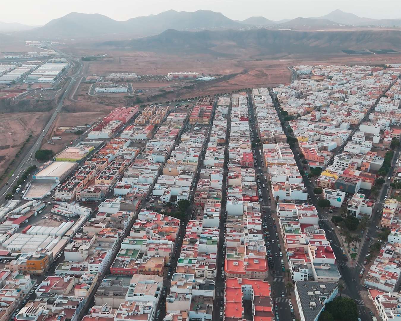
Puerto del Rosario itself is not why ships come here. It is a working administrative town of straight streets and low white houses, with an open-air collection of sculpture along the front and a single landmark church, Nuestra Señora del Rosario. An hour covers it. Everything that makes the island worth a day lies north.
Does the sand in the Corralejo dunes come from the Sahara?
No. This is the most persistent story on Fuerteventura and it is wrong in a way worth understanding, because the truth is better.
The sand is organic. Shells, snails and the calcareous skeletons of marine animals, ground down in the shallows, washed ashore and carried inland by the trade wind. Analysis of the grains settled it: this is a beach that kept moving, not a desert that blew across from Africa. The dunes are still moving today, which is why the road through them is swept rather than fixed.
The area has been protected since 1982. The two large hotels standing at the northern edge were built before that, which is why they are there and why nothing else is. That is the whole explanation for the strangest sight in the park — two tower blocks in the middle of a protected dune field.
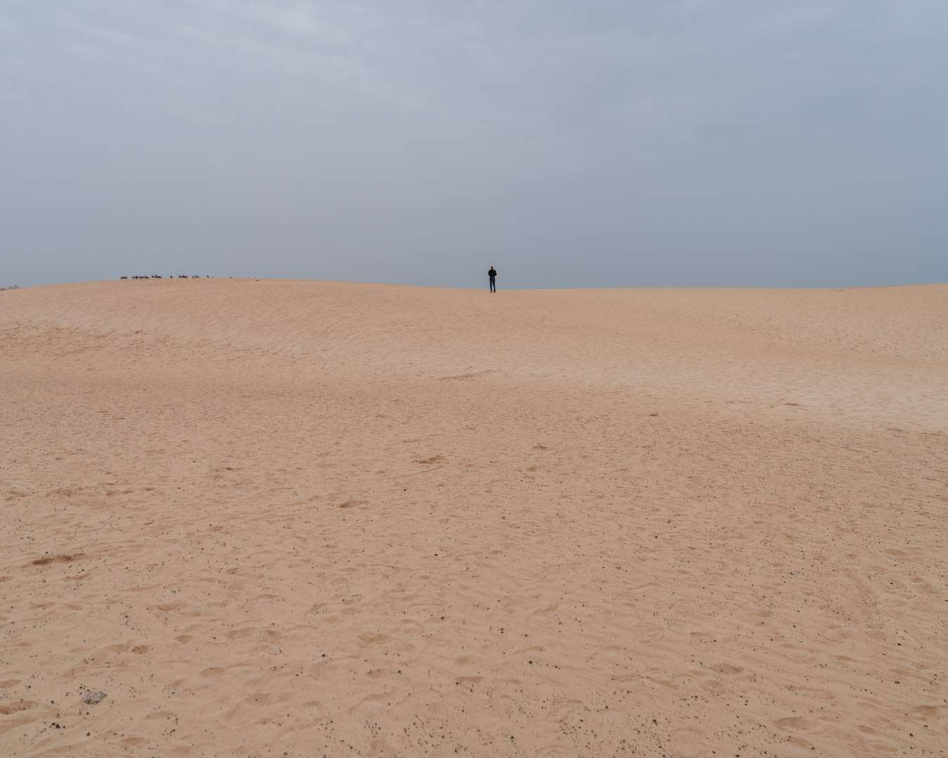
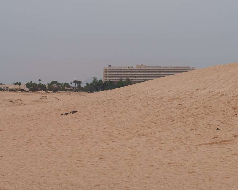
The Bayuyo craters: the youngest volcanoes on the island
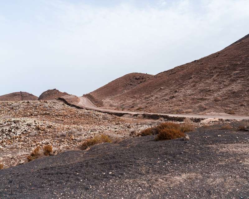
West of the dunes the track runs through the Malpaís, and the chain of cones on the skyline is the reason the north of Fuerteventura exists at all. Seven volcanoes stand in a line about four and a half kilometres long — Montaña Colorada, Calderón Hondo, Caldera Rebanada, Caldera Encantada, Las Calderas, Bayuyo, Montaña San Rafael. They belong to the island’s fourth and most recent eruptive phase. The published dates vary between roughly 15,000 and 50,000 years ago.
Together with the neighbouring group they laid down the Malpaís de Corralejo and added something like 110 square kilometres to the north of the island. Everything the jeep drives on that morning — the track, the dunes on top of it, the village at the end — is that eruption.
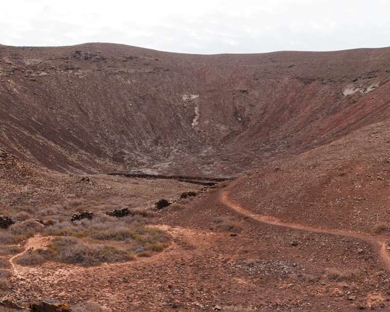
El Cotillo: a tower from 1700 and a whale on a plinth
The Torre del Tostón was built around 1700 on the ruins of an earlier tower, by the military engineer Claudio de L’Isle, against pirates operating out of France, England and North Africa. Two floors, three iron cannons. The harbour below it was a station on the trade route between Madeira and Fuerteventura; today it holds boats that go out for the day’s catch. The tower is open as a small exhibition room and doubles as the best viewpoint in the village.
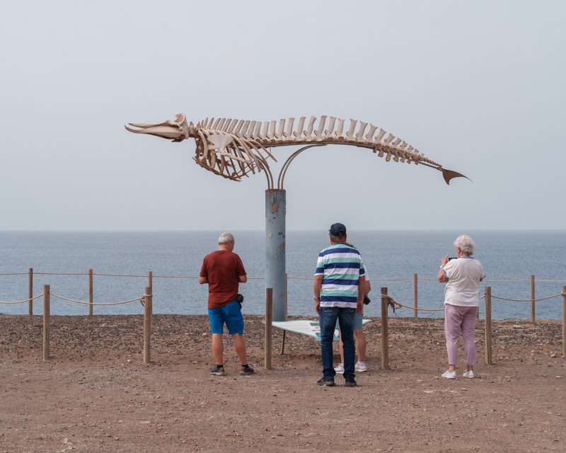
Beside the coast path stands a whale skeleton raised on a frame, with an interpretation board naming the species that strand here. It is an odd and rather good piece of municipal honesty: the island puts its dead on display as a teaching trail.
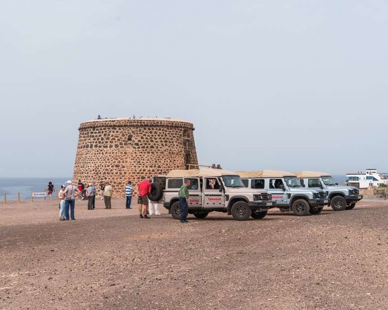
The lagoons, and why the tide decides this stop
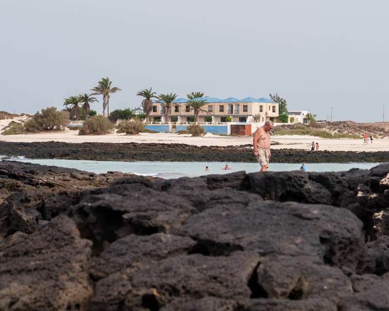
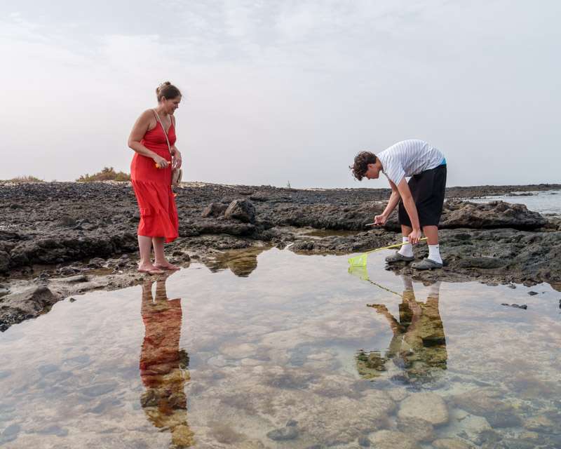
North of the village the Atlantic opens a series of shallow lagoons behind reefs of lava. At low water they are flat, clear and warm enough to stand in; the brochure offers a short swim “if the weather allows”, which in practice means if the tide allows.
A few hundred metres along the same coast the sea does the opposite — surf straight onto black rock, no bathing, red flag country. Same ocean, same morning, two completely different propositions. If swimming matters to you, ask the driver which end you are being taken to before you pack a towel.
The squirrel that should not be here
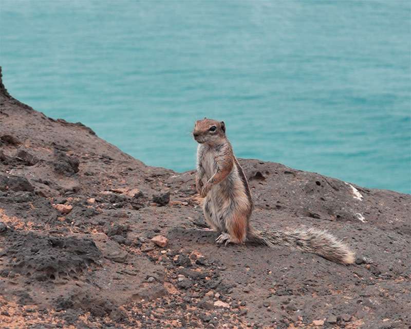
You will see them on the rocks at the viewpoints, upright and entirely unbothered: Barbary ground squirrels, native to the Atlas mountains of Morocco. They were introduced to Fuerteventura in 1965, and the story told on the island is that a resident brought a pair home from Sidi Ifni as pets, one escaped and the other was let go. Their descendants now sit on walls across the entire island.
They are tame because they are fed, and feeding them is discouraged — they are an introduced species on an island with ground-nesting birds. Photograph them and keep your lunch to yourself.
Tindaya: 401 metres of rock that was here first
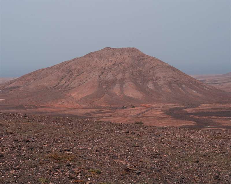
On the way back, off to the left, a bare cone rises out of flat ground. Montaña de Tindaya is 401 metres high and was sacred to the Majos, the island’s first inhabitants, who cut around three hundred engravings into the summit rock in the shape of the soles of feet. Most of them are on the side facing Tenerife and Gran Canaria, and on a clear day the Teide shows on that horizon — which is the reading usually given to them, though it is a story the island tells rather than a measurement anyone has published.
The mountain is a protected natural monument, and it has been the subject of a forty-year argument about a proposed sculpture inside it. The jeep does not stop. It is the one thing on the route that was here before everything else: the sand blew in, the squirrel was carried in, the tower was built against outsiders. Only the mountain was always here.
How much does it cost?
| Option | Price 2026 | Note |
|---|---|---|
| Ship’s jeep safari, approx. 4 hrs | €109 | Phoenix Reisen excursion list for MS Amadea, as at June 2026 |
| Local operator, small-group 4×4 safari, pick-up at the cruise terminal | €49 | Advertised route: dunes, Bayuyo volcano, El Cotillo — the same ground |
| Ship’s coach tour “northern Fuerteventura”, approx. 4 hrs | €39 | Dunes, Corralejo, El Cotillo, La Oliva — no off-road section |
| Ship’s coach tour to the interior (Betancuria, Ajuy, Pájara), approx. 4.5 hrs | €39 | The other half of the island |
| Ship’s full day “Viva Fuerteventura”, approx. 8 hrs with lunch | €79 | North and interior combined |
| Ship’s transfer to Caleta de Fuste, approx. 5 hrs | €25 | Transfer only, no guide |
| Island bus, line 6, Puerto del Rosario–Corralejo, one way | €3.40–3.50 | Tiadhe; cash to the driver; stops at the dunes |
Ship’s prices are from our own excursion list and differ between lines. The bus fare was checked against two sources for the 2026 season.
Tour, local operator, or on your own?
Three honest answers, depending on what you want from the day.
If you want the off-road section, you need a jeep — and then the only question is whose. Sixty euros a head is a large gap for the same track, and a small-group operator picking up at the terminal is not an exotic arrangement here; it is advertised. The counter-argument is the usual one: the ship waits for its own excursions and not for anyone else’s. On a call that ends at 18:00 with a four-hour tour, that risk is small, but it is yours to carry.
If you want the dunes and Corralejo without the track, take the bus. Line 6 leaves the station on Avenida Diego Miller roughly every half hour on weekdays, hourly at weekends, takes about 35 to 45 minutes and costs €3.40 to €3.50 one way, paid in cash to the driver. It stops at the dunes on the way. Done as a return trip with two or three hours in Corralejo, that is a full and genuinely good day for under eight euros — and it is the option none of the tour pages will tell you about.
If you want El Cotillo without a tour, you need a hire car. The bus network does not serve it usefully from the port, and the taxi fare there and back is in the territory where the €49 tour wins.
Whatever you choose, be back at the pier 45 to 60 minutes before all-aboard. The coast road north is fast; the inland road back is not.
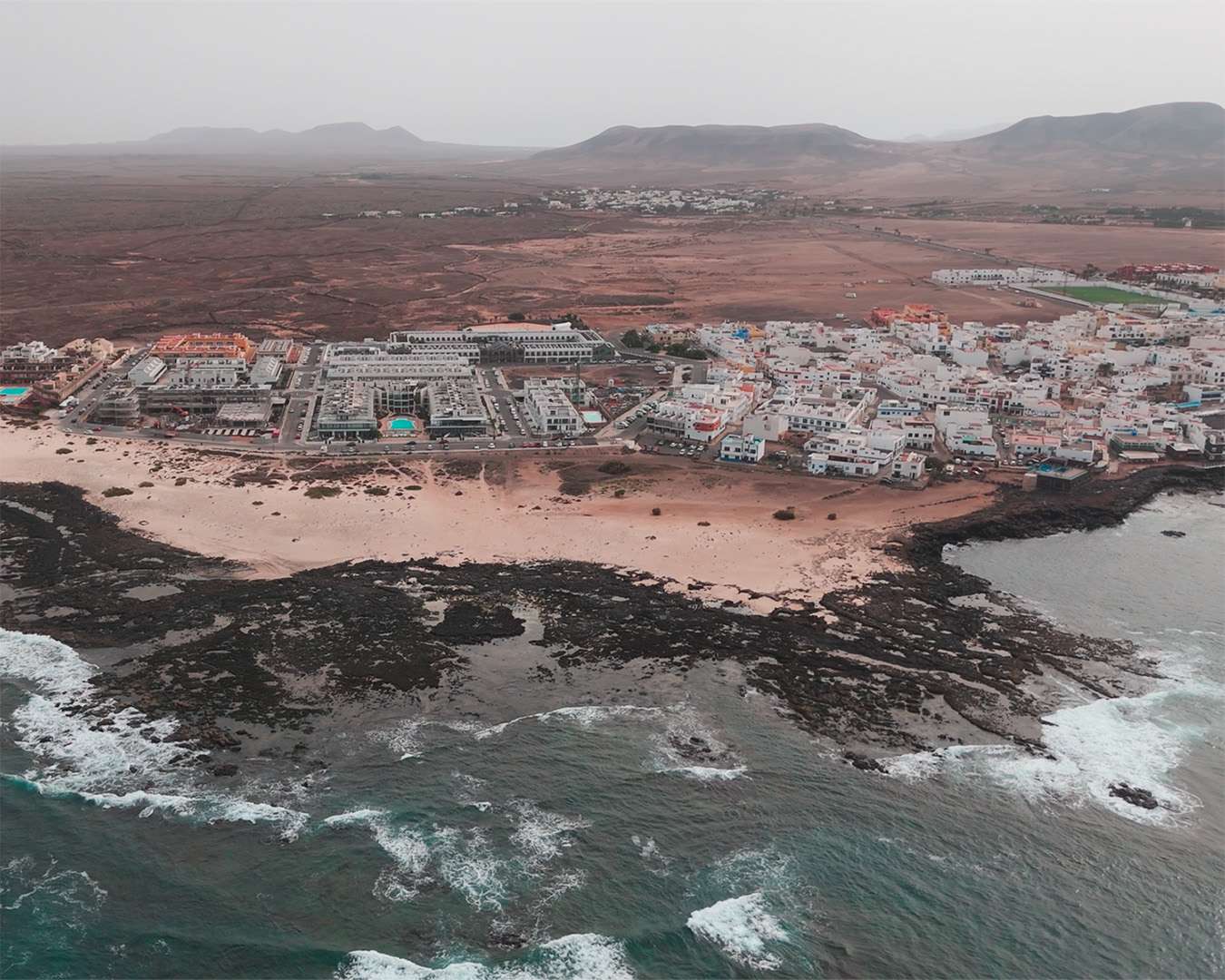
Photo stops and light
The dunes are the hardest subject on the route and the one everyone photographs. At midday under haze they go flat and white and give you nothing. What works is the opposite of the wide shot: a single figure for scale on a ridge, or the line where the sand runs up against black lava.
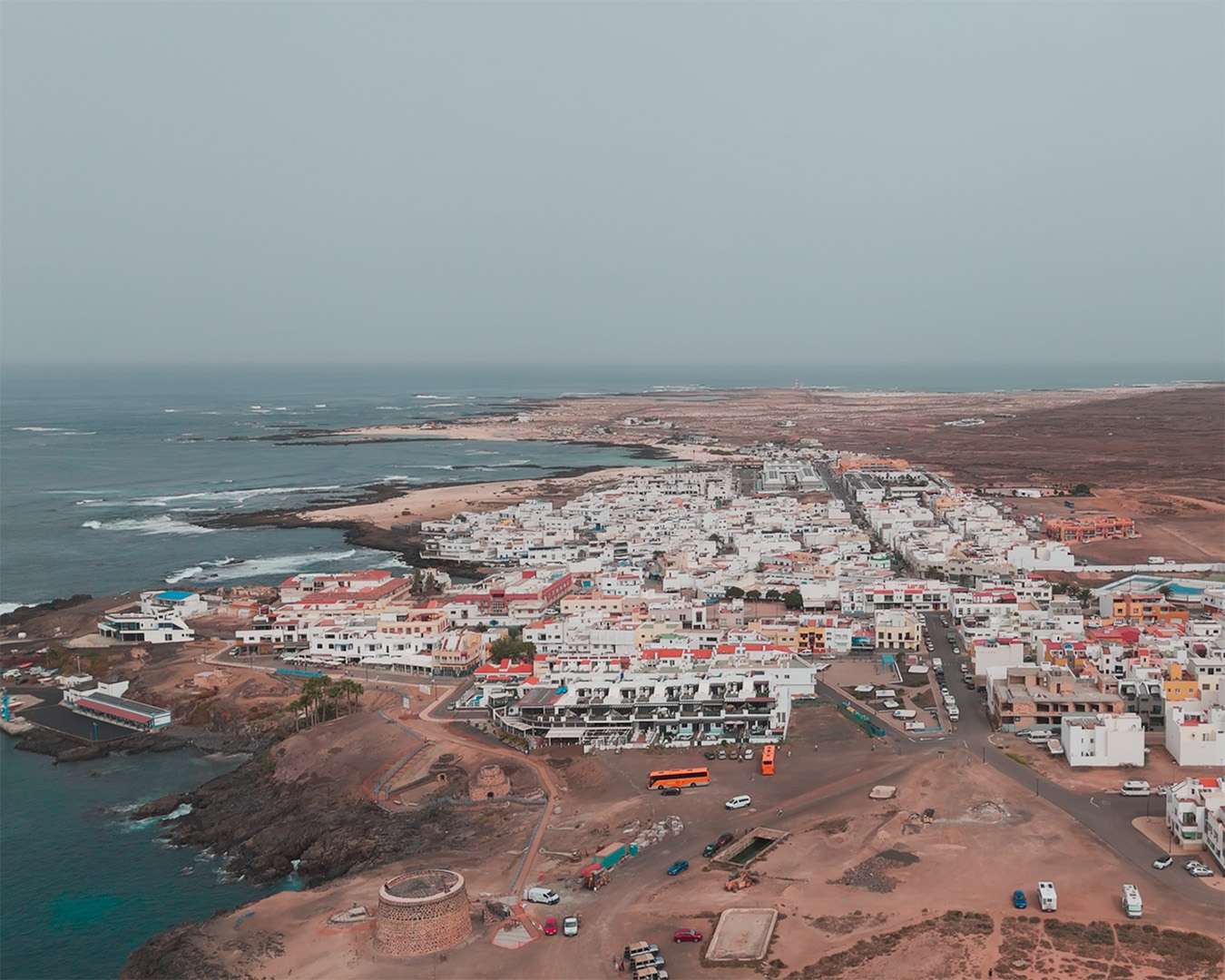
El Cotillo is the better place. The tower reads against the sea from the track below it, the whale skeleton is a gift of a silhouette, and the lagoons at low water are the one aerial subject on the island where the colour does the work. The village from above — white houses, turquoise water, black reef — is the picture this route is for.
On the way back, Tindaya from the road is a simple shape and benefits from the haze rather than suffering from it.
One note on the scale of the place: I recorded the route on the day. From the pier and back, the loop runs 97 kilometres with 912 metres of climbing — in a little over four hours, every stop included. Fuerteventura looks flat from the ship. It is not.
What I would do differently next time
With a call from 08:00 to 18:00, I would book the small-group jeep for the morning and keep the afternoon for the bus. The track and El Cotillo need a vehicle; Corralejo and the dunes do not, and the dunes are a better place at five in the afternoon than at eleven in the morning, when the light finally comes off the sand at an angle.
And I would ask one question before booking any of the three: which end of El Cotillo, and at what state of the tide. That single answer decides whether the stop is a swim in a warm lagoon or twenty minutes of looking at surf.
Related: Tenerife Island Tour: Cañadas del Teide, Icod and Puerto de la Cruz · Santa Cruz de Tenerife Cruise Port: The Las Raíces Hike · Santa Cruz de La Palma Cruise Port: Is the Green North Worth the Tour? · Cruise Ports on Your Own