
Visited: June 2025, on a call of MS Amadea.
Måløy is a fishing town on the island of Vågsøy, at the mouth of the Nordfjord on Norway’s west coast. Almost everything worth seeing lies just outside it: the Kannesteinen rock ten kilometres west, the seventeenth-century Vågsberget trading post, and a coast that runs straight out into the open Atlantic. Half a day covers the essentials. A full day covers the island.
Distances and opening arrangements checked September 2026 — verify before you travel.
Where is Måløy?
Måløy sits on the eastern shore of Vågsøy, one of the outer islands of Vestland county, roughly 210 kilometres north of Bergen. The Måløy bridge carries the road over the sound to Deknepollen on the mainland, and the open sea is a few kilometres away in three directions.
About 3,300 people live here, and the town is one of Norway’s most important fishing ports — a working harbour rather than a resort. Until 2020 it was the administrative centre of Vågsøy municipality; since Vågsøy and Flora merged into Kinn Municipality it has lost that status, which is why older guidebooks and newer maps disagree about what Måløy is the centre of.
Måløy in one day: what is where, and how far
Almost everything worth seeing around Måløy lies outside the town, and the distances are short. Nothing on this list charges admission.
| Place | From Måløy centre | Time needed |
|---|---|---|
| Vågsberget trading post | a few kilometres, on county road 601 | about 1 hour |
| Kannesteinen rock, Oppedal | about 11 km west, 15–20 minutes by car | 15–20 minutes |
| Refviksanden beach | about 8 km, white shell sand, 1.5 km long | 30–60 minutes |
| Kråkenes lighthouse | about 25 km, the exposed north-western tip | half a day with the drive |
| Harbour and viewpoint above town | on foot | 1 hour |
With a full day and a car, the natural loop is road 601 west: Vågsberget, then Kannesteinen at Oppedal, then Refviksanden, and back along the coast. With half a day — a cruise call, or a stop on a road trip — take Kannesteinen and the harbour and leave the rest.
Kannesteinen: a rock on a stem
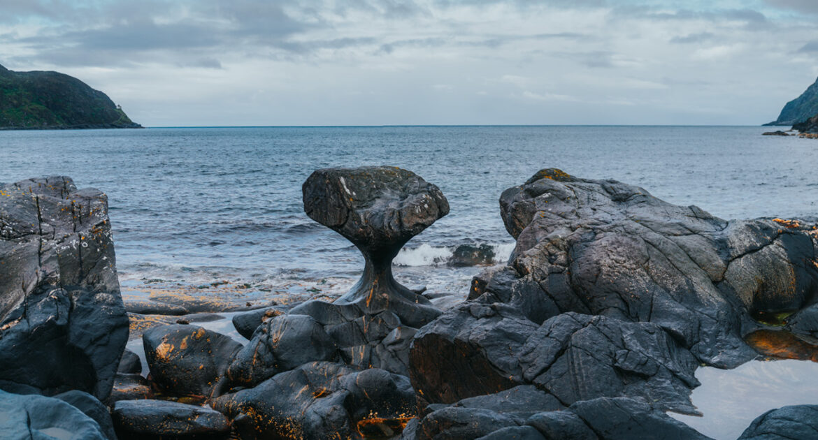
The Kannesteinen stands on a rocky shoreline at Oppedal, about eleven kilometres north-west of Måløy, where the sea works against bare slabs of rock. It is three metres high and shaped like a cup on a narrow stem — the result of thousands of years of waves, ice and moving stones grinding at the same block from below.
There is a car park by the shore, an information board and a short path down to the viewing point. Entry is free and most people stay fifteen to twenty minutes. Wear something with grip: the rock slabs are slippery when wet, and in a storm the waves reach a long way above the waterline.
Vågsberget: the trading post on the shore
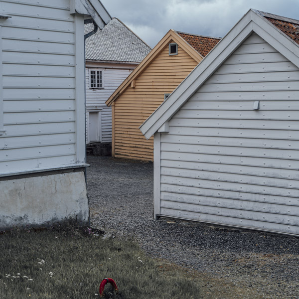
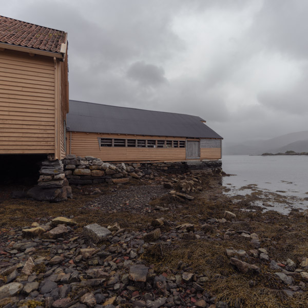
Vågsberget is one of the best-preserved trading posts on the Norwegian coast, dating from the seventeenth century, when a licensed merchant house on an exposed shore was both shop and shelter for everyone sailing past. The buildings stand where they always did, a cluster of white and yellow timber right at the waterline, with the boathouse below.
Its rights covered the goods that mattered on this coast — dried fish, flour, salt — and the exhibits are about that trade rather than about scenery. An hour is enough. Guided tours run in summer.
The outer coast: Refviksanden and Kråkenes
The west side of Vågsøy faces the open Atlantic, and two places there are worth the drive if you have the day.
Refviksanden is a kilometre and a half of white shell sand, regularly named among Norway’s best beaches and almost always empty, because the water is cold and the wind is not optional.
Kråkenes lighthouse stands on a knife-edge promontory at the north-western tip of the island. The original tower of 1906 burnt after an Allied air raid in 1945; the present one was first lit in 1950 and automated in 1986, and it now holds a small restaurant and rooms. It is one of the most exposed positions on this coast — the storm footage that circulates every winter is filmed here. The road out is as much the point as the lighthouse.
A short walk around the harbour
If you have only half a day, the town itself rewards a slow walk. The harbour is the heart of the place: trawlers and supply boats come and go, gulls work the quay, and the Måløy bridge arcs over the sound toward the mainland. A short climb up the hill behind the centre opens a wide view over the roofs, the harbour and the open sea beyond — the clearest way to understand how completely Måløy is shaped by the water around it.
Operation Archery: what happened here on 27 December 1941
Måløy carries a heavier history than its size suggests, and it is the reason the name appears in British and Norwegian war records.
On 27 December 1941, British Commandos and the Norwegian Independent Company 1 landed on Vågsøy and on the islet of Måløy in a combined air, sea and land operation led by the cruiser HMS Kenya. The targets were the fish-oil plants and stores — the Germans used fish oil in the manufacture of explosives — along with fuel and ammunition depots, the telephone exchange and the shipping in the sound. The raiders were back aboard by early afternoon, having sunk ten vessels and destroyed the installations, at a cost of seventeen British dead and fifty-three wounded against roughly 120 German dead and 98 taken prisoner.
Captain Martin Linge, who led the Norwegian contingent, was killed attacking the German headquarters; the Norwegian special forces company that grew out of his unit still carries his name. The raid’s largest consequence was strategic rather than local: Hitler responded by moving some 30,000 troops to Norway and pouring concrete into the coastal defences, men and material that were then not available elsewhere.
A small memorial near the shore marks it. It takes five minutes and changes how the harbour reads.
Arriving in Måløy by cruise ship
Måløy is a small call and a quiet one. Ships lie in the sound by the town, and the centre begins at the quay — no shuttle, no transfer, and no crowd, because the ships that come here are not the large ones.
For a half-day call, the honest plan is Kannesteinen by taxi or excursion bus and the rest on foot. Nothing on the island needs a ticket, so the only thing to budget for is the ride out to Oppedal and back.
How to get to Måløy
From Bergen it is about 210 kilometres by road, north on the E39 with a ferry crossing on the way. The express boat is the alternative and often the better one: it leaves Strandkaiterminalen in Bergen twice a day and takes about four and a half hours up the coast.
Once you are there, a car is what makes the island usable. Buses serve the settlements, but not on a visitor’s timetable.
Photo notes, and when to go
May to September has the stable weather and the long light. Winter is dramatic and often impassable on the outer roads — which is a different article.
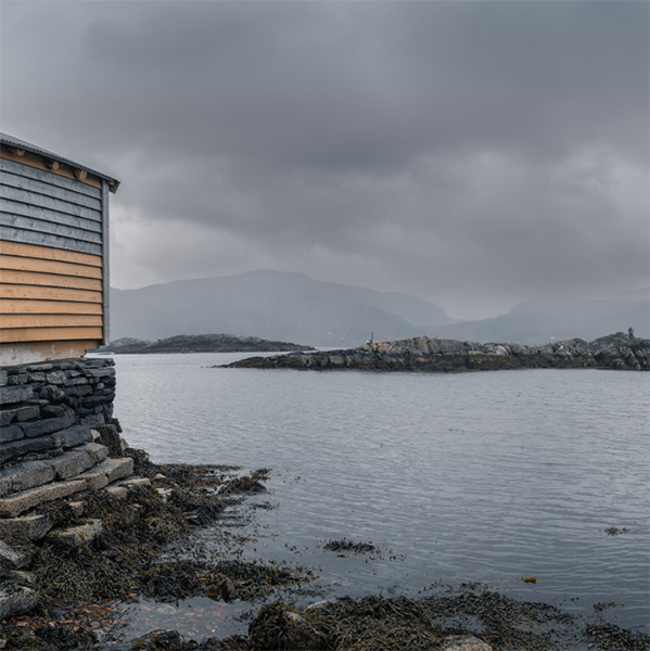
The town is grey and yellow timber against grey rock, and it photographs better under cloud than under sun; the colour is in the boats and the paintwork, not in the sky. At Kannesteinen the problem is scale again: the rock is three metres high and reads as thirty or as one, depending entirely on what else you put in the frame.
Related: All cruise ports on your own · Unforgettable Lofoten · Geiranger: Dalsnibba to the Eagle Bend · More from Norway
Written by Jan Madeus — ship’s videographer at sea since 2008. I go ashore in the same ports as the passengers, with the same few hours and the same deadline. More about me.