
Visited: 1 October 2026, on an overnight call of MS Amadea at Ponta Delgada. We left the terminal just before nine and were back at the gangway at a quarter past twelve. Prices and rules checked October 2026 — verify against the linked sources before you travel.
Sete Cidades is a caldera about five kilometres across at the western end of São Miguel, with two lakes on its floor and a village of under eight hundred people between them. From the Ponta Delgada cruise terminal it is roughly forty minutes each way. The ship’s 4×4 excursion is priced at €75 and billed as three and a half hours; ours ran three and a quarter. What the money buys is not the commentary. It is the unsurfaced track along the crater rim, which a hire car cannot use and which is closed to general traffic in places.
The run at a glance
| Berth | Portas do Mar cruise terminal, in Ponta Delgada itself. About 200 m to the port gate, another 350 m to the centre. |
| Time | Advertised 3.5 hours. Our own run: 08:55 to 12:15, four stops, unhurried. |
| Price | €75 per person as a ship’s excursion, autumn 2026. Independent operators in Ponta Delgada sell comparable half-day 4×4 tours. |
| Caldera | About 5 km across. Azorean sources give 5.3 km and a drop of up to 630 m; the English-language geological description gives 6 × 5 km and wall heights of 200–500 m. |
| Lake | 4.35 km², maximum depth 33 m, surface at 259 m. Hydrologically one body of water, not two. |
| Vista do Rei | 544 m above sea level |
| On foot | PR4 SMI Mata do Canário – Sete Cidades, 12.1 km along the rim, about 3.5 hours, 643 m of descent. Linear, not a loop. |
| Not allowed | Swimming in the lakes; camping anywhere but the official site in the village |
| Difficulty | 1 out of 5 — you are driven. Not suitable for anyone with back trouble; the rim track is rough. |
Where the ship berths in Ponta Delgada
Ships lie at Portas do Mar, the terminal built into the seafront of the town. From the gangway it is about 200 metres to the port gate and another 350 into the centre. There is no shuttle because there is nothing to shuttle.
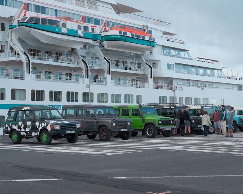
The Land Rovers wait on the quay, in a row under the ship’s side. That is worth knowing if you are deciding on the morning itself: you can see what you are getting into before you commit.
The road out: a landscape that was planted
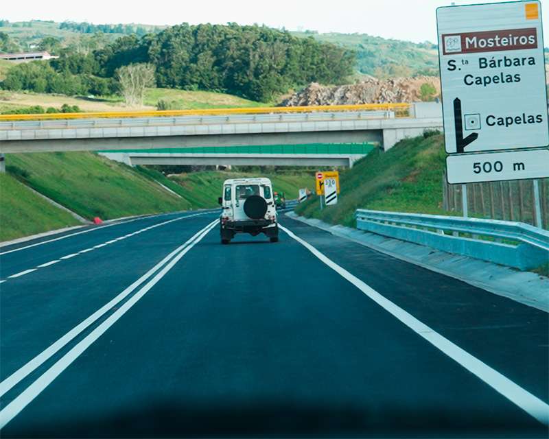
The route runs north first — Capelas, Santo António, Santa Bárbara — through pasture that looks like the natural state of the island and is not.
When the Portuguese arrived in the fifteenth century, São Miguel was uninhabited and covered in laurel forest. Very little of that is left. What stands here now is grazing and Cryptomeria japonica, the Japanese cedar, brought in during the nineteenth century as a timber crop. The regional forestry service counts 12,698 hectares of cryptomeria stands today, roughly a third of the archipelago’s forest land. The hydrangeas along the verges came from Asia too.
It is a useful thing to know before the viewpoints start. Almost everything green you will photograph here was put there on purpose.
What you are actually looking at
Behind Remédios the road turns off and climbs to the rim.
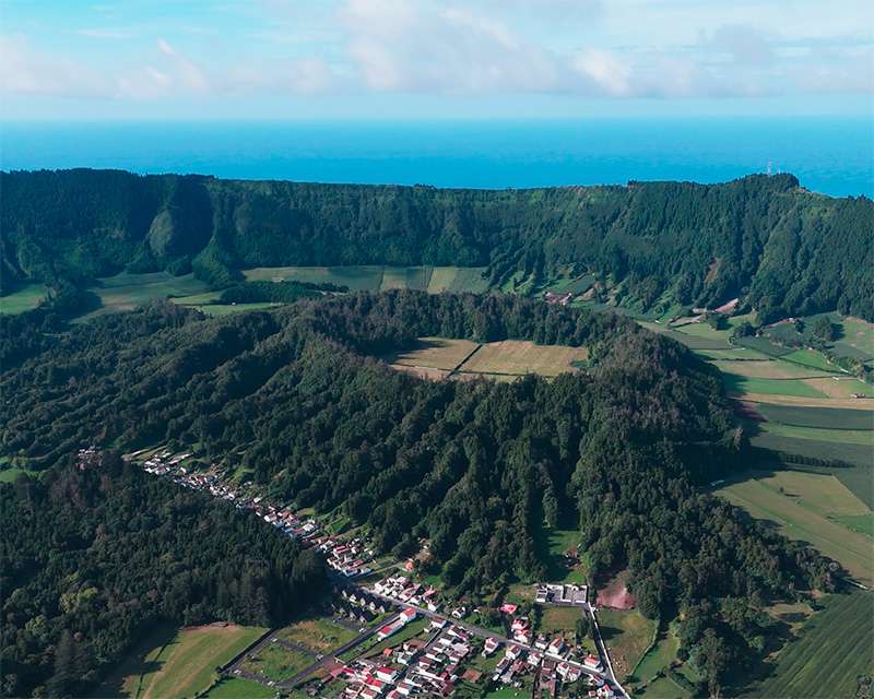
What you see from up there was once a mountain. Around 36,000 years ago the magma chamber beneath Sete Cidades emptied and the summit dropped into the space it left. The collapse came in phases — the geological record puts them at roughly 35,700, 28,750 and 15,740 years ago — and what remained is a near-circular basin with water standing on its floor.
The figures depend on which source you take. Azorean descriptions give a diameter of 5.3 kilometres and a drop of up to 630 metres from the highest point of the rim to the lake. The geological literature describes the caldera as 6 by 5 kilometres with walls between 200 and 500 metres. Both are defensible; they are measuring different things. Standing on the edge, the number that matters is the one you feel: the lake surface is at 259 metres and the rim above it runs to well over 800.
Blue lake, green lake — and why
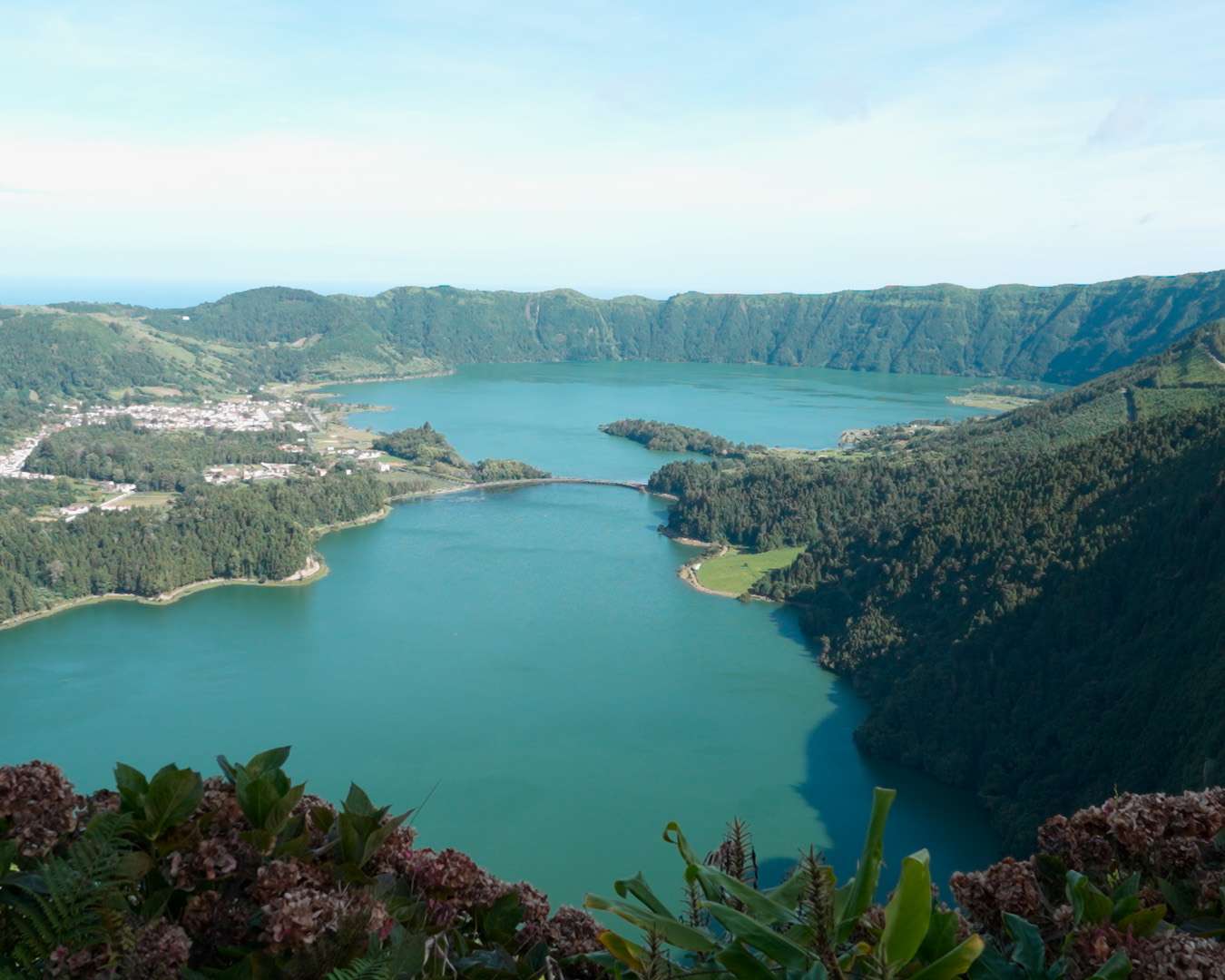
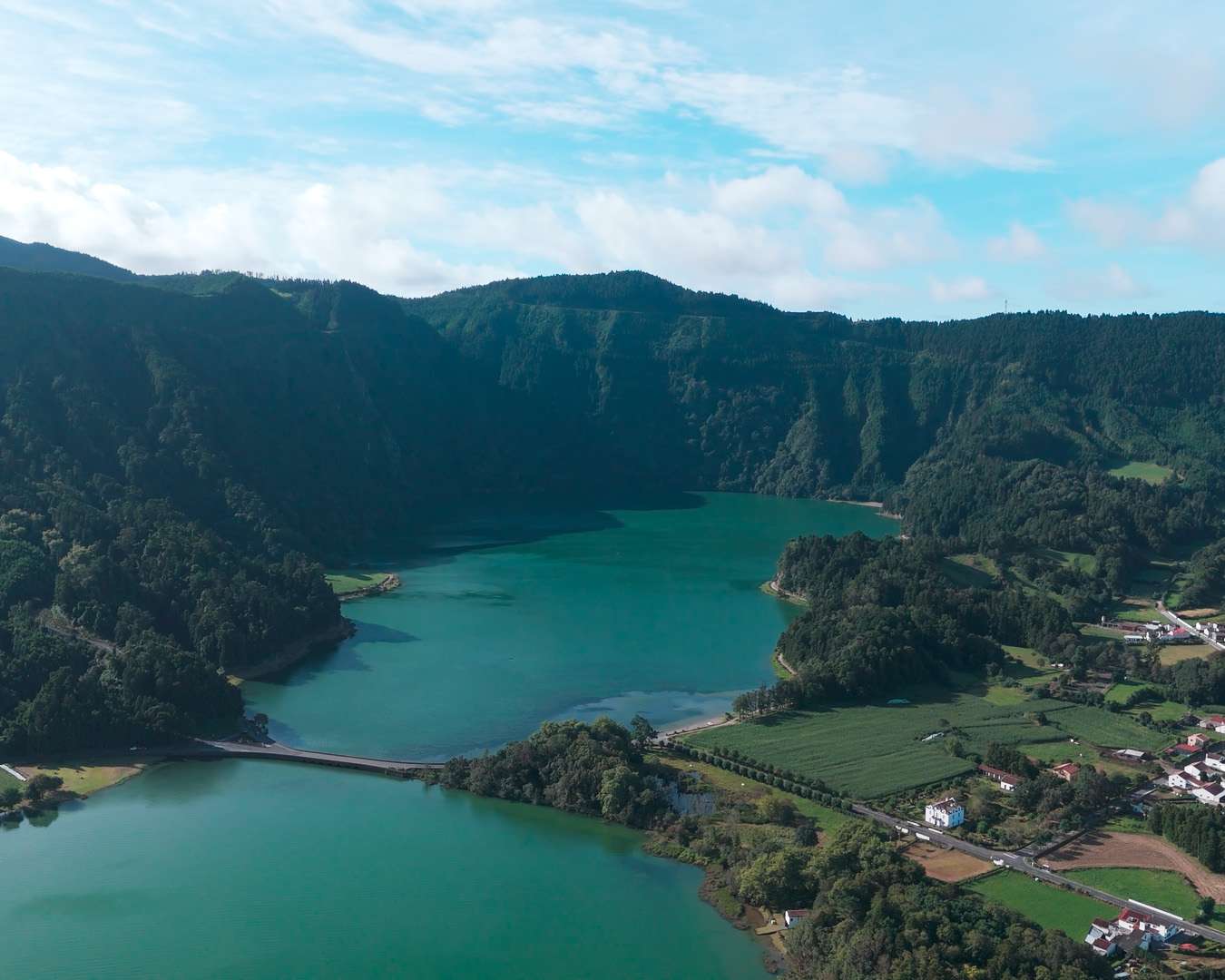
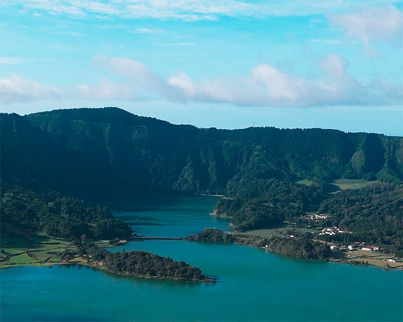
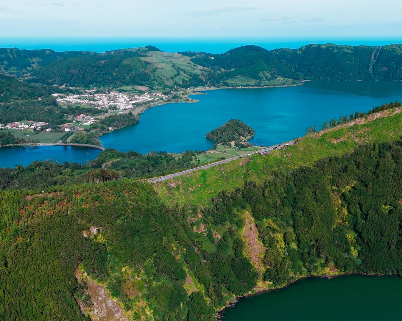
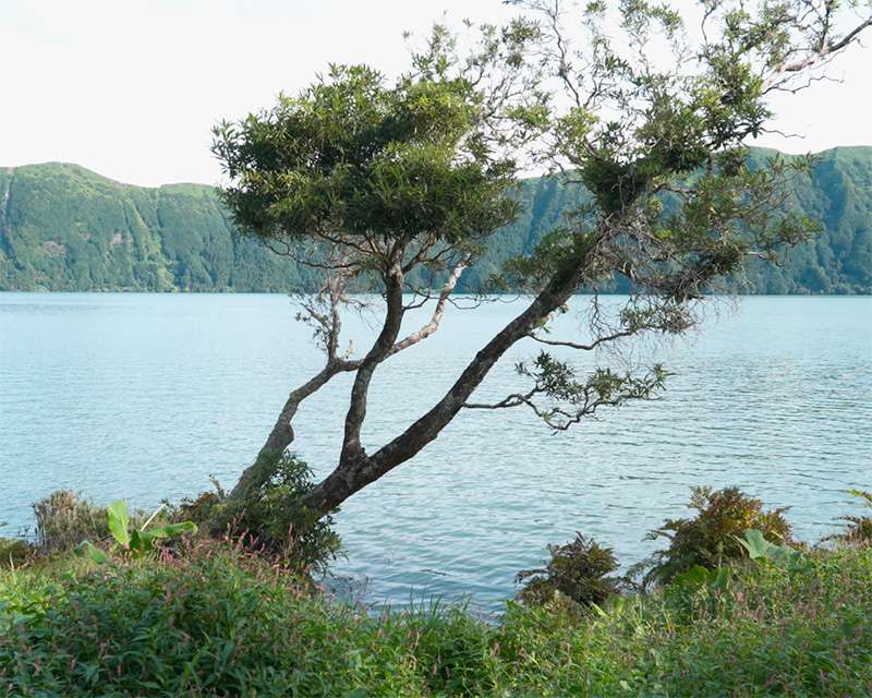
The two lakes are one lake. Lagoa Azul and Lagoa Verde are joined under the causeway that crosses between them; hydrologically it is a single body of water of 4.35 square kilometres, 33 metres deep at most. What differs is depth, the vegetation on the slopes above each half, and the angle at which the light arrives.
The legend about the princess with blue eyes and the shepherd with green ones, and the tears they cried at parting, is the better story. The geology is the one you can check.
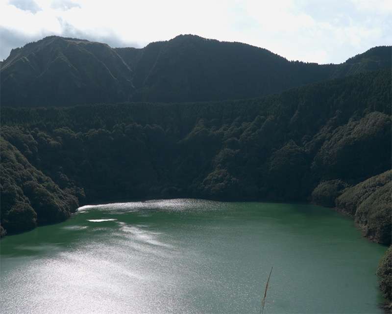
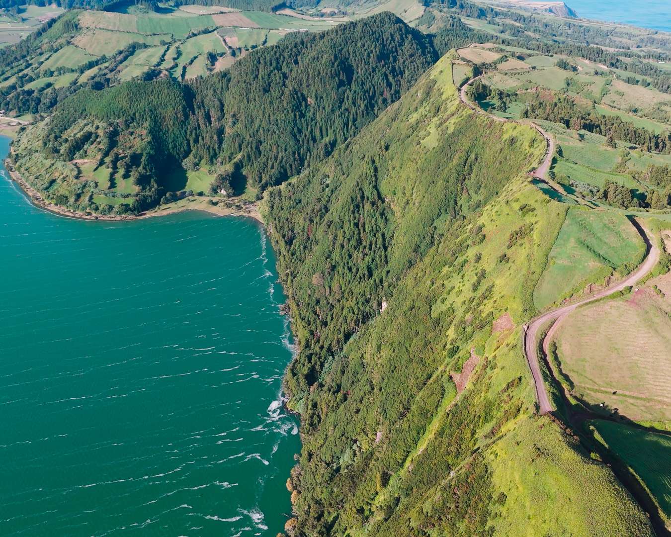
Higher on the rim sits the Lagoa de Santiago, a small crater of its own above the big lakes, dark green and almost perfectly round. It is the shot most people miss because the famous view points the other way.
The village on the crater floor
Inside the basin lies the village of Sete Cidades — 793 people at the 2011 census, cut off from the rest of the island by the crater wall. The valley was settled late, once the landowner José Bettencourt made tracts inside the caldera available.
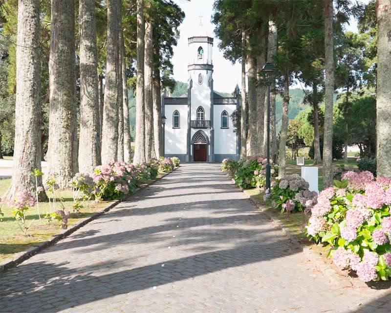
The church of São Nicolau stands at the end of an avenue of cryptomerias planted for the purpose, headed by two araucarias. It was built on a vow made in 1849 by Colonel Nicolau Maria Raposo de Amaral (1770–1865) and his wife Teresa Ermelinda Rebelo, designed in neo-Gothic by Manuel Lamberto Monteiro, and consecrated on 16 August 1857.
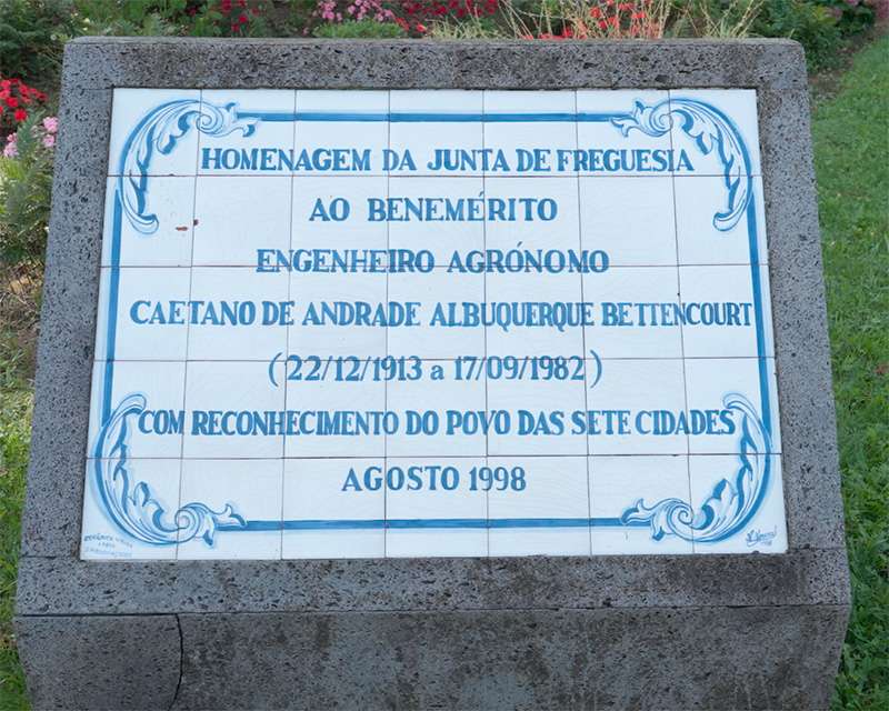
In front of it stands a stone tablet set with azulejo. The village thanks an agricultural engineer on it — Caetano de Andrade Albuquerque Bettencourt, 1913 to 1982, the plaque laid in August 1998. Not a saint, not a navigator. A man who had to do with soil. On an island built out of planted forest and imported pasture, that is a more honest monument than most.
Vista do Rei, and a hotel that lasted eighteen months
The best-known viewpoint on the rim stands at 544 metres and is called Vista do Rei because King Carlos I and Queen Amélia stood there on 6 July 1901.
Beside it is a ruin. The Monte Palace was a five-star hotel with 88 suites, two restaurants, shops and a nightclub. It opened in April 1989 and had closed again by the end of 1990 — about eighteen months of trading. It was built for this view, on a rim that is in cloud most of the time. Entering it is forbidden now; the structure is unsafe.
Why a 4×4 rather than a hire car?
This is the honest answer to the only question worth asking about this excursion.
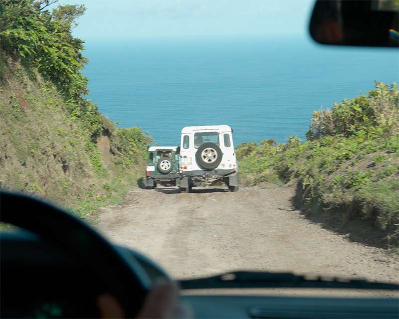
The paved viewpoints — Vista do Rei, the Boca do Inferno car park, the village itself — are all reachable in an ordinary rental car, and if that is all you want, hire one at the terminal and keep your €75. What you cannot do in a hire car is the track along the top of the rim: unsurfaced, rutted, running right along the edge with the Atlantic on one side and the caldera on the other. Parts of it are not passable in a normal car at all. Parts are closed to general traffic by the authorities, and the operators hold the permits.
We drove a good stretch of it in clear weather, which on this rim is the exception rather than the rule. That is what the money is for.
You can also walk the rim, and it costs nothing: the waymarked PR4 SMI Mata do Canário – Sete Cidades runs 12.1 kilometres along the ridge and down into the village, about three and a half hours, 643 metres of descent. It is linear, not a circuit, so you need transport at one end — and on a port day it is the whole day, not part of it.
What you are not allowed to do at Sete Cidades
Swimming is prohibited. The catchment management plans for the lakes of São Miguel, Sete Cidades included, expressly rule out bathing use, and there are signs on the shore saying so. People ignore this and people have drowned here.
Wild camping around the lake is not permitted either. There is one official site, the Zona de Campismo das Sete Cidades in the village, with basic sanitary facilities and cold water. If you are travelling independently and had pictured a tent on the shore, that is the only legal version of it.
Photo notes
The problem at Sete Cidades is not finding the view. It is that the view is enormous and the camera flattens it.
From Vista do Rei the classic frame — both lakes, the causeway, the village — needs something in the near ground to give the drop any scale. Hydrangeas on the rim do it; so does the edge of the track. Without a foreground the picture reads as a postcard of green.
The frames I came back with that I would use again were not the famous ones. They were taken from the rim track: the vehicle ahead on the unsurfaced edge with the Atlantic eight hundred metres below, and the Lagoa de Santiago as a dark circle above the big lakes. Both only exist because of where the 4×4 could stop.
On timing: a morning departure puts the sun behind you for the north-western part of the rim and more or less into the lens by the time you reach Vista do Rei. If you have a choice, take the earlier slot.
How much return buffer do you need?
Forty minutes back to a terminal that is in the middle of town. On a ship’s excursion the buffer is not your problem; independently, be back at the gate an hour before all-aboard, and allow more if you have walked the PR4 and are relying on a taxi out of the village.
We were back at the gangway at a quarter past twelve. The crater stays what it is: the shape a mountain left behind when it went.
Sources: Sete Cidades Massif — caldera dimensions and collapse phases · Lagoa das Sete Cidades — lake area, depth, elevation · Igreja de São Nicolau — vow, architect, consecration 1857 · Vista do Rei and the Monte Palace hotel · PR4 SMI Mata do Canário – Sete Cidades · Turismo dos Açores — Sete Cidades campsite · Direção Regional dos Recursos Florestais — cryptomeria in the Azores · Açoriano Oriental — bathing prohibited in the São Miguel lakes
Related: Lagoa do Fogo from Ponta Delgada — day one of the same overnight call · All cruise ports on your own · São Miguel: Furnas and the north coast · All Azores stories
Written by Jan Madeus — ship’s videographer at sea since 2008. I go ashore in the same ports as the passengers, with the same few hours and the same deadline. More about me.